Every deed needs a way to describe exactly what land it covers. In the United States, two systems handle most of that work. One uses compass directions and distances.
The other points to a recorded map. Knowing which one applies to your property can save you a lot of confusion when you read your deed.
Key Takeaways
- Metes and bounds uses direction and distance from a point of beginning to describe a property’s full boundary.
- Lot and block uses a short reference to a lot number, block number, and recorded plat map.
- Rural, irregular, and historically older parcels tend to use metes and bounds.
- Planned subdivisions built after the 19th century almost always use lot and block.
- A single property can be governed by both systems at once, one for the subdivision’s outer edge and one for the individual lot.
What is a Metes and Bounds?
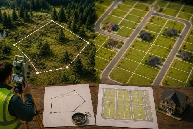
A metes and bounds defines a property’s boundaries using compass direction and distance, starting and ending at a fixed reference point called the point of beginning. “Metes” refers to distance, usually in feet, and “bounds” refers to direction.
The description reads like a set of walking directions. It starts at a marker, natural or man made, then lists a series of calls such as “north 45 degrees east, 200 feet” until the boundary line closes back at the point of beginning.
Surveyors originally marked these points with trees, rivers, boulders, or stakes. Today they use metal pins and GPS coordinates for accuracy.
This method predates the United States. It traces back to English common law and was the primary way land was described before the federal government adopted the rectangular survey system in 1785.
It remains the standard for many older parcels in the original thirteen colonies and in states such as Georgia and the Carolinas, where historic land grants still define ownership.
Metes and bounds works well for irregular or rural parcels where a simple grid does not fit the land. It also creates more room for dispute.
If a landmark named in a decades old deed has washed away or been removed, surveyors have to reconstruct the original boundary from historical records.
What is a Lot and Block?
A lot and block identifies a property by its lot number, its block number, and a reference to a recorded plat map on file with the local government. It is the standard method for parcels inside a platted subdivision.
The process starts when a developer takes a larger tract of land and divides it into a grid of blocks and individual lots.
A licensed surveyor prepares a plat, a detailed map showing every lot, block, street, and easement in the development.
Once the local government approves and records that plat, it becomes the official legal reference for every lot inside it.
After that, a full legal description can be as short as one line: “Lot 12, Block 4, Maple Grove Estates, as per plat recorded in Plat Book 18, Page 42, of the Public Records of [County], [State]”. Anyone can pull the recorded plat and see the exact size, shape, and location of that lot within the subdivision.
Lot and block is most common in cities, suburbs, and exurbs built after the 19th century, when American cities began expanding into farmland and developers needed a fast, repeatable way to sell individual parcels. It is also used in parts of Canada.
The outer boundary of the subdivision itself is usually set first using metes and bounds or the rectangular survey system. Lot and block then divides that larger boundary into sellable pieces.
Check Also: Letters Testamentary vs Letters of Administration
Metes and Bounds vs Lot and Block: Key Differences
| Factor | Metes and Bounds | Lot and Block |
|---|---|---|
| How it identifies land | Direction and distance from a point of beginning | Lot number, block number, plat reference |
| Typical setting | Rural land, irregular parcels, older properties | Platted subdivisions, cities, suburbs |
| Reference document | The deed itself carries the full description | A recorded plat map, cited by book and page |
| Length of description | Long, technical, lists every boundary call | Short, often a single sentence |
| Common historical origin | English common law, used before 1785 | Emerged in the 19th century as cities expanded |
| Main risk | Landmarks can move, disappear, or be misread | Errors in the plat itself, since every lot depends on it |
| Where it still dominates | Original thirteen colonies, Georgia, the Carolinas | Most modern residential developments nationwide |
When Each System Applies to Your Property
The system used for a specific property is not a matter of buyer preference. It depends on how and when the land was originally surveyed and divided.
If a property sits inside a named subdivision with a recorded plat, the deed almost always uses lot and block. Check the deed for a lot number, a block number, and a plat book and page reference.
If a property is rural, irregularly shaped, or was carved out of a larger tract without going through subdivision, the deed likely uses metes and bounds. Look for compass bearings such as “N 45° 25′ 20″ E” and a named point of beginning.
Some deeds combine both. A metes and bounds description might define the outer edge of a larger tract, while a separate section references the lot and block within a smaller platted section of that same tract.
How to Read Each Type of Legal Description
A metes and bounds description follows a repeatable pattern: point of beginning, then a series of direction and distance calls, then a closing line back to the start. Example format:
“Beginning at a point from which the southeast corner of Section 15, Township 3 South, Range 12 East of the 5th Principal Meridian bears South 20° East 980 feet…”.
A lot and block description is far shorter and reads more like an address inside a filing system:
“Lot 16, Block 8, Cedar Hills Addition, as per plat recorded in Plat Book 11, Page 58, of the Public Records of [County], [State]”.
To verify either type, request a copy of the referenced plat or survey from the county recorder or clerk of court.
For metes and bounds, a licensed surveyor can physically confirm the boundary calls on site. For lot and block, the recorded plat itself shows the exact lot dimensions and placement within the subdivision.
Conclusion
Both systems answer the same question, where does this property start and end, but they answer it in different ways.
Metes and bounds gives a detailed, step by step boundary walk. Lot and block gives a short reference to a recorded map that holds the detail instead.
Knowing which one applies to a property tells you where to look for the underlying proof: a surveyor’s calls on the ground, or a plat sitting in the county recorder’s office.